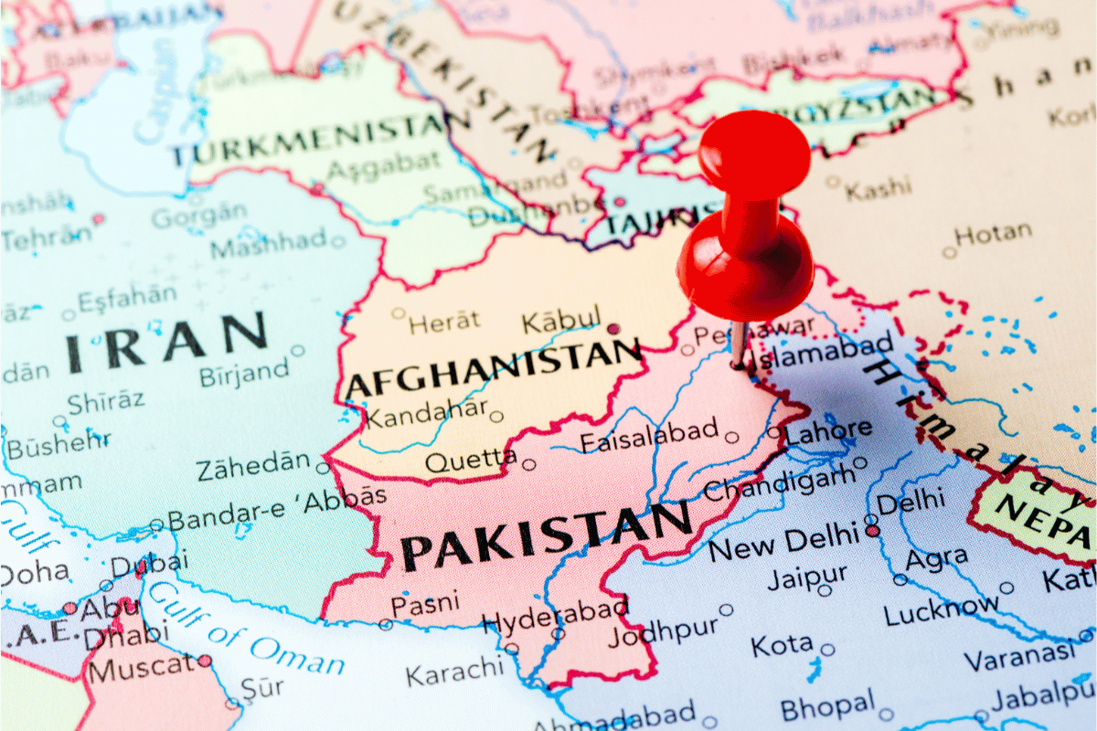
Pakistan is a country located in South Asia. An Indo-Iranian-speaking population predominantly occupies this state. It is mainly bordered to the north by Afghanistan, to the southeast and east by India, to the west by Iran, to the northeast by China, and to the south by the Arabian Sea. Keep reading to know how many provinces in Pakistan and their facts.
The nation shares deep cultural and historical ties with neighboring countries like India, Iran, and Afghanistan. The country has been struggling with political issues and their stability for many years.
Karachi is the largest city and situation in the south of the state on the Arabian Sea coast. On the other hand, Islamabad is mainly located in the Himalayan foothills and is the capital city.
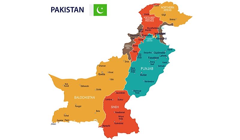
Even though, the Kashmir dispute is ongoing and so many people think it’s four. However, there are 5 provinces of Pakistan. These are Punjab, Baluchistan, Sindh, Khyber Pakhtunkhwa, and Azad Jammu Kashmir.
Provinces of Pakistan
In this article, we will talk about what are the 5 provinces of Pakistan in detail.
Punjab
The term Punjab comes from the word “five rivers”. It was given about the Jhelum, Ravi, Chenab, Sutlej, and Beas. These rivers drain the area. This province is present in the eastern part of Pak.
The Sindh bordered it by the south. And to the west, Khyber Pakhtunkhwa and Baluchistan meet at borders. Islamabad and Kashmir are in the north. Indian states are in the northeast and Rajasthan in the east.
It occupies an area of 79,284 squares miles. It makes it the second-largest region after Baluchistan. The population is 91,370,615.
Khyber Pakhtunkhwa
It is predominantly referred to as Northwest Frontier Region. Azad Kashmir is at the borders of northeast and east of it. Afghanistan is to the west and north. Baluchistan is in the southwest and Punjab is in the southeast.
On the western border with Afghanistan, the areas are under tribal and administrate by Federal Government. The capital city of the region is Peshawar. It occupies an area of 28,773 square miles with a population of 21,392,000.
Sindh
This region is present in the southeastern part of the state. Punjab borders it in the northeast, Baluchistan in the north and west, the Arabian Sea to the south, and Indian states Gujrat and Rajasthan in the east.
Karachi, the largest city, is the capital of Sindh. The area under this region is about 54,407 square miles. It has a population of about 35,864,000.
Baluchistan
It is formerly situation in the western part of the country. Sindh borders it in the southeast, Punjab in the east, Khyber Pakhtunkhwa in the northeast, and the Arabian Sea in the south. The capital city of this area is Quetta.
The total area under this region is 134,051 square miles. It is home to a population of about 7,450,000.
The Kashmir dispute
The control over Kashmir has always been a dispute between India, Pakistan, and China. These countries rule some parts of the territory but not completely. Kashmir is present in the western Himalayas.
The Azad Kashmir is mainly administrated by Pak and refers to as the independent territory. Even though Muzaffarabad is the capital city of Azad is under the control of Pak.
Baltistan and Gilgit are the rest of the territory also administrated by Pak.
How many provinces in Pakistan
| Rank | Province | Population | Land Area (km sq.) |
| 1 | Punjab | 110,012,442 | 205,344 |
| 2 | Sindh | 47,886,051 | 140,914 |
| 3 | Khyber Pakhtunkhwa | 35,525,047 | 101,741 |
| 4 | Baluchistan | 12,344,408 | 347,190 |
